The benefits of
GPS TRACKING
GPS short for Global Positioning System is a linked system of navigational satellites and ground stations used to pinpoint your location anywhere on Earth. Requiring unobstructed sightlines and at least four satellites, GPS Tracking can calculate the exact location in space and time of a GPS receiver - like the one in your phone. While GPS was designed for navigation, it is now part of nearly every aspect of life.
Your Need
Find your way with global positioning
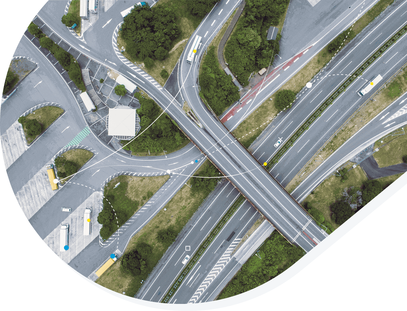
While GPS was designed for navigation, it is now part of nearly every aspect of life and is used for navigation on sea, land and air. By combining our technology with expert GPS knowledge, we can support safety for people, animals and possessions, route optimization and reducing vehicle fuel costs.
Milestone Systems
World-class expertise
Milestone Technology Partner Finder is created by Milestone Systems, the world’s leading provider of Video Management Solutions (VMS). All software and hardware promoted have received verification to be optimized for Milestones video management software XProtect ® so you can collect video and use it intelligently to solve challenges.
The video management solutions community
Milestone Technology Partner Finder
Discover how your needs can benefit from the latest technology innovation and connect with the right people and documentation. Milestone Technology Partner Finder offers an intuitive structure for connecting and forging relationships and providing you with a battery of verified smart software and hardware to build upon.

Find your way with global positioning
GPS Tracking
The GPS tracking system uses 24 solar powered satellites (with six spares,) that continuously orbit earth along six different paths, traveling at an altitude of 20,000 km. Their routes are mapped so that anywhere on Earth, at any time there are at least four satellites "visible" in the sky. The satellites have atomic clocks on board and the GPS system must make allowances for Special Relativity to ensure accurate time.
Satellite signals travel at the speed of light. Using the mathematical principle called trilateration, GPS offers the ability to locate and track a subject, pinpointing longitude, latitude, ground speed and course of direction. The system operates independently from telephone or internet reception and requires only a GPS receiver. The latest stage of accuracy enhancement uses the L5 band and has an ability to pinpoint to within 30 centimeters. To save energy, real-time GPS trackers do not send a stream of data but report positions at pre-determined intervals. Typically, the fastest reporting interval is ten seconds.
GPS systems are used for navigation on sea, land and air. It also supports safety for people and possessions, route optimization and reducing vehicle fuel costs. GPS is also now used in wildlife tracking and protection, providing automated collection of thousands of point locations to more precisely define home ranges and migration routes.
GPS integrates with programs such as Motion Detection, Perimeter & Intrusion and Gun Shot Detection programs. Gun Shot Detection monitors events in real-time using both the gun shot GPS coordinates and XProtect camera coordinates.
Unique needs. Customized solutions.
Real-time tracking and protection
By combining video management software with expert GPS technology, you can stay in charge of your people, possessions and routes.
Solutions (36)
Find customized solutions for your needs
Show all (36)


GET STARTED NOW
Book a one-to-one demo
See Milestone in action with a demo that's customized to your business and needs.