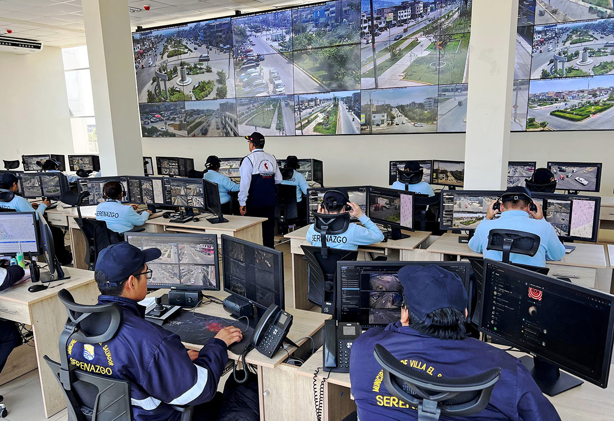
Security teams today are often responsible for monitoring environments that span multiple buildings, campuses or geographic regions. In these environments, quickly understanding where an incident is happening can be just as important as seeing the incident itself.
Smart Map in XProtect adds a visual layer to video operations by connecting cameras, alarms and devices to their physical locations through interactive maps and floorplans. Instead of searching through long camera lists, operators can move visually from a global overview down to a specific location, floor, camera or device.
In this article, we’ll look at how Smart Map works in XProtect, how it supports situational awareness and how organizations can get started with map-based monitoring.
In large security environments, operators are often responsible for monitoring hundreds or even thousands of cameras spread across buildings, campuses or geographic regions. Traditional menus that simply list camera names can make that difficult. Even when operators know which camera they need, understanding how that camera relates to the surrounding environment often requires jumping between views, maps and systems.
That’s why XProtect now uses Smart Map functionality across its map experience in every variant: to bring operational context directly into video operations.
Instead of navigating through camera lists or nested folders, operators can move visually through their environment using interactive maps, floorplans and geographic layouts. A user might begin with a regional or global map showing multiple facilities, then drill down into a specific site, building or floor to investigate an event in more detail. Administrators can also organize maps into layered views for different floors, buildings or operational areas, helping teams maintain awareness across both indoor and outdoor environments.
Within the map itself, cameras, alarms and integrated devices become part of a connected operational view. This approach to camera mapping helps operators understand not only what devices are available, but where they are located in relation to the surrounding environment. Operators can hover over cameras to open live previews, visualize camera fields of view and quickly understand what devices are nearby during an incident. In environments with integrated systems, maps can also display alarm activity and access control events directly within the interface. This becomes especially valuable in environments where understanding physical context is just as important as seeing the video itself.
Take a look at the video above for an overview of what you can do with Smart Map in XProtect.
Smart Map is typically configured during initial system deployment by an integration partner or administrator. However, administrators can access the Management Client at any time to configure map settings, assign map sources and organize the operational views that operators will use inside Smart Client. Additionally, users can create their own private, map-based views within Smart Client after initial set up to support specific operational workflows.
Basic setup workflow in the Management Client
1. Under Client, select Smart Client Profiles
2. Select the desired Smart Client profile
3. Open the Smart Map tab at the bottom of the Management Client. (See the Management Client layout for more details.)
4. Configure the preferred map source and map settings
Smart Map supports multiple map source options, allowing organizations to tailor map-based monitoring to their facilities, workflows and deployment requirements. Online map services can support broader geographic visibility across campuses, cities or distributed facilities, while uploaded floorplans and offline map services may be better suited for indoor environments or isolated deployments without internet connectivity.
OpenStreetMap is commonly used by XProtect customers for free, online geographic mapping. However, Google Maps integrations are also available through API-based services, though usage costs may apply depending on the deployment.
Check our documentation on Geographic Backgrounds for more information.
5. Add cameras, devices and operational views
Once maps are configured, administrators can place cameras and devices directly onto maps and organize them into layered views for different buildings, floors or operational areas. Operators can then navigate visually between locations, open live camera previews and interact with connected systems directly from the map interface.
Once configured, Smart Map allows operators to navigate visually between locations, preview live camera feeds, identify alarm activity, adjust camera views and select from multiple devices directly within the map interface.
Smart Map is also available in the Mobile Client with a similar navigation experience to that of the Smart Client.

For more advanced configuration or deployment support, it is best to contact your Milestone channel partner, contact our Milestone Care team or visit our Support Center for access to self-service resources.
From school campuses and manufacturing facilities to citywide operations centers, organizations use Smart Map to transform cameras and devices into a visual operational picture. The following examples show how map-based monitoring helps operators navigate complex environments, respond more effectively and maintain situational awareness at scale.
Manufacturing: simplifying global security operations
Merit Medical uses Smart Map to manage more than 900 cameras across manufacturing and distribution facilities around the world. As the company's camera network grew, traditional naming conventions became increasingly difficult to navigate, requiring extensive training for new security personnel. By using visual camera mapping instead of relying solely on camera names, operators can quickly navigate between sites, buildings and floorplans.
Using Smart Map, operators can start with a global view of the organization and drill down into specific sites, buildings and floorplans to quickly locate the cameras they need. Hover previews provide instant visibility into camera views, while color-coded icons help distinguish between different camera types throughout the environment.
The visual approach has dramatically reduced training time for new personnel and improved operational efficiency across Merit's global security team. Smart Map also supports system health monitoring by visually identifying cameras that require attention, helping operators quickly spot and respond to issues across any site.
Merit Medical uses Smart Map to help operators navigate facilities visually through color-coded camera icons, field-of-view overlays and live previews.
Education: helping first responders navigate school campuses faster
For one New York K-12 school district, improving school safety meant ensuring that local police, fire departments and emergency responders could access video during an incident.
To support that goal, the district deployed XProtect and configured Smart Map so officers can locate relevant cameras using a visual map of the campus and understand what is happening before entering the scene.
Integrated with access control and video intercom systems, the system helps school administrators, district personnel and first responders work from the same operational picture during an emergency, improving situational awareness when every second counts.
The system also supports day-to-day operations. For example, facility personnel can use Smart Map to access parking lot cameras remotely after a snowy night to determine whether schools should be plowed or closed for the day.
Public safety: maintaining situational awareness across a growing city
As the City of Parramatta in New South Wales, Australia, expanded, its security team faced a common challenge: managing more facilities, more cameras and more technologies without creating operational complexity. Today, the city's security operations center uses XProtect to monitor more than 1,000 cameras across 110+ facilities.
Smart Map helps operators move seamlessly between these locations while maintaining a consistent workflow, making multi-site security monitoring more efficient and intuitive.
Instead of switching between separate systems, operators can navigate unfamiliar buildings using visual floorplan overlays, quickly locate relevant cameras and respond to alarms with associated video views that are automatically surfaced within the interface.
By bringing video, access control and building systems into a single operational view, the city has improved situational awareness across its facilities while creating a security environment that can continue to scale without requiring proportional increases in staffing.
As organizations grow, so do the number of cameras, devices and systems they rely on every day. Smart Map helps bring those technologies together within a visual interface that provides operators with the context they need to make informed decisions.
From a single building to a global enterprise, Smart Map enables map-based monitoring that helps teams move naturally through their environment and maintain situational awareness when it matters most.
Contact us for more information on Smart Map and start increasing operational awareness for your organization today!